Spedizione gratuita con Packeta per un prezzo superiore a 79.99 €
BRT 7.99 Punto BRT 7.99 DHL 7.99 HR Parcel 7.49 GLS 3.99

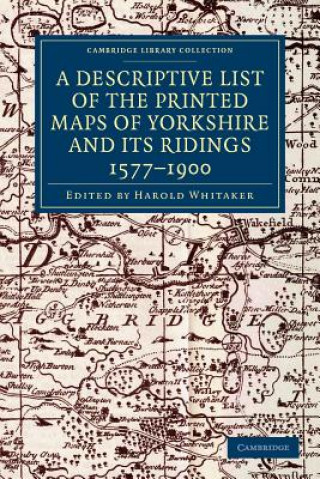
Descriptive List of the Printed Maps of Yorkshire and its Ridings, 1577-1900

Lingua IngleseInglese
Libro In brossura
Libro Descriptive List of the Printed Maps of Yorkshire and its Ridings, 1577-1900 Harold Whitaker
Codice Libristo: 02059104
Casa editrice Cambridge University Press, febbraio 2013
Originally founded in 1863 to promote interest in the history and archaeology of the Huddersfield ar... Descrizione completa
? points 146 b
61.97
Magazzino esterno Inviamo tra 19-25 giorni

30 giorni per il reso


Potrebbe interessarti anche


I MIGLIORI
English in Mind Level 1 Workbook Herbert Puchta / In brossura
common.buy 14.55
Mindful Games Activity Cards Susan Kaiser Greenland / Carte
common.buy 21.93
Pride and Prejudice Jane Austen / In brossura
common.buy 16.80
Midnight Sun TRISH COOK / In brossura
common.buy 11.98
Billion Trips a Day I. Salomon / In brossura
common.buy 220.39
Handbook of Microsimulation Modelling Cathal O´Donoghue / Rigido
common.buy 278.52
Education and Public Policy in Australia Simon Marginson / In brossura
common.buy 51.91
9th World Luis John Soria / In brossura
common.buy 16.58
Shadow State Alan White / In brossura
common.buy 26.54
Ritual Structures in Chicana Fiction Helane Androne / Rigido
common.buy 72.67
Succession E. van der Maarel / Rigido
common.buy 142.25
Enzyme Chemistry Colin J. Suckling / In brossura
common.buy 220.39
Meter in Poetry Nigel FabbMorris Halle / In brossura
common.buy 85.73

Originally founded in 1863 to promote interest in the history and archaeology of the Huddersfield area, the Yorkshire Archaeological Society expanded its purview in 1870 to cover the whole of Yorkshire. In 1884 it began publishing its Record Series, which aimed to make historical information available through the reprinting of original documents, diaries, letters, and charters. First published in 1933 and reprinted for the society in 1971, this well-illustrated work is an extensive catalogue of maps of the Yorkshire area, drawn between 1577 and 1900. The editor's introduction sets the maps within the history of cartography in Britain, and in the context of pioneering work by previous cartographers. The entries give a description of what each map depicts, along with information on dates and dimensions. This work remains a valuable resource for local historians and geographers.

Informazioni sul libro

Titolo completo Descriptive List of the Printed Maps of Yorkshire and its Ridings, 1577-1900
Lingua Inglese
Rilegatura Libro - In brossura
Data di pubblicazione 2013
Numero di pagine 318
EAN 9781108058827
ISBN 1108058825
Codice Libristo 02059104
Peso 47
Dimensioni 154 x 229 x 20
Regala questo libro oggi stesso
È facile
1 Aggiungi il libro al carrello e scegli la consegna come regalo 2 Ti invieremo subito il buono 3 Il libro arriverà all'indirizzo del destinatario

Accesso

Accedi al tuo account. Non hai ancora un account Libristo? Crealo ora!

 
obbligatorio
obbligatorio

Non hai un account? Ottieni i vantaggi di un account Libristo!

Con un account Libristo, avrai tutto sotto controllo.

Crea un account Libristo